


Geography
Geography Overview
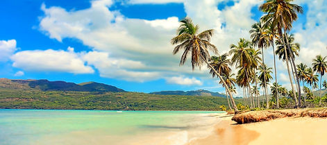
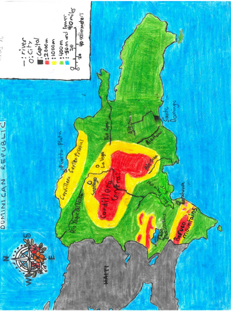
The Dominican Republic is a relatively small country, with a land area of 18,791 square miles. It is located in the Caribbean occupying the eastern two-thirds of Hispaniola with the rest of the island making up the country of Haiti. The Dominican Republic has a tropical climate with easterly winds cooling the country reduce temperatures during the dry season, making it a huge tourist attraction. The Dominican Republic has rugged terrain with four nearly parallel mountain ranges covering the country, with mountain peaks such as Pico Duarte, going as high as 10,000 feet above sea level. It also has many fertile valleys such as Cibao, which spans 150 miles in the upper reaches of the country. The Dominican Republic also has several distinct water features, such as deep lakes like the Lago de Enriquillo, which goes as much as 150 feet below sea level, and several large rivers including Yaque del Norte, which is 184 miles long The people who live in the Dominican Republic use these lakes for irrigation and hydroelectric power. The Dominican Republic also has a diverse range of flora and fauna, having over 5600 species of plants, many of which occupy the lowlands, such as mangroves and sweet acacia, as well as some that occupy higher elevations such as the cedar and sierra palms. Over one-third of plants are unique to the Dominican Republic, adding to the country’s attractions for visitors interested in the vegetation. The Dominican Republic also has an impressive animal kingdom with abundant large lizards and tarantulas and a robust marine ecosystem. Unfortunately, however, many animals in the Dominican Republic are endangered with the laws that protect them being poorly enforced. Overall, the Dominican Republic has diverse and impressive geographical features, making it an ideal place for tourists exploring different climates and physical features.